Bucureştii de azi păstrează pe alocuri caracteristicile Bucureştilor de demult numai că oamenii de azi nu au la îndemână datele (poate nici interesul) pentru a percepe şi a recunoaşte această moştenire. Fizic, ea nu prea mai este palpabilă decât în cazul bisericilor în jurul cărora s-au constituit tradiţional comunităţile care au făcut ceea ce numim câteodată la plural – Bucureştii.
Mai nimic altceva nu s-a păstrat din vremurile acelea aşa că, trebuie să ştim că atunci când mai găsim în oraş clădiri civile care să mai păstreze urme din vremuri – să zicem – ale Revoluţiei lui Tudor Vladimirescu, atunci acelea sunt cu adevărat rarisime relicve vii.
Mai toate clădirile care dau parfumul istoric cel mai puternic al oraşului vechi în ochii noştri de astăzi sunt făcute undeva în ultimul sfert al secolului al XIX-lea iar casa din strada I.L. Caragiale nr. 11 face şi ea parte din această zestre culturală ce a început să fie risipită din ce în ce mai accelerat în ultimii 40 de ani.
Acest oraş a fost unul care s-a întins aproape nestingherit din epoca medievală până la începuturile administraţiei sale moderne apărută ca urmare a ocupaţiei ruseşti din anii 1830, ocupaţie ce a impus Regulamentele Organice şi primele reglementări urbanistice din capitală.
Printre acestea, la 1831, Regulamentul conţinea şi această remarcă, a faptului că oraşul trebuia neapărat constrâns de nişte limite între care să poată fi administrat, modernizat şi, nu în ultimul rând, controlat economic prin taxe.
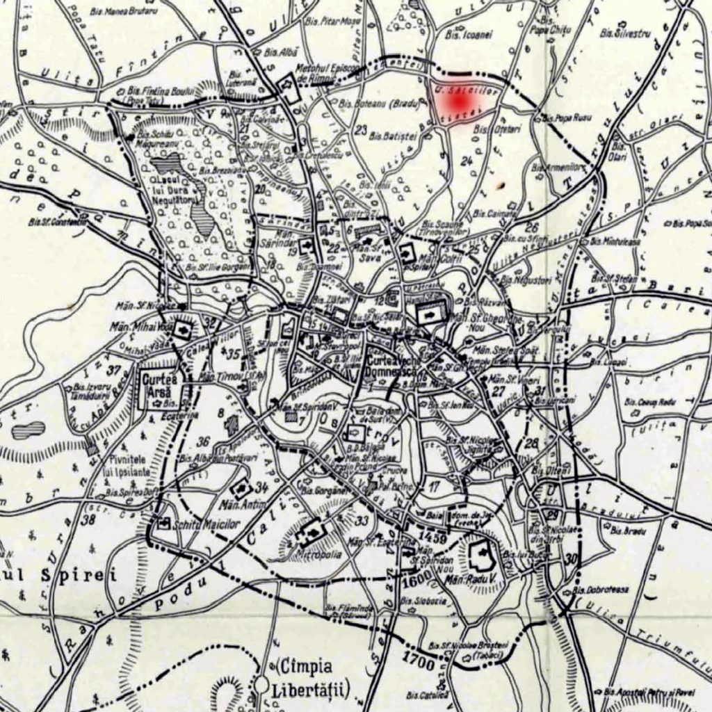
Am spune astfel că prin delimitarea pusă în scris de acest regulament avem o primă mărginire certă a oraşului. Pentru epocile anterioare, de-a lungul timpului, mari istorici ai sec. XIX şi ai sec. XX s-au străduit să interpreteze vechi documente şi să imagineze care ar fi putut fi limitele aşezării ce a servit drept capitală stabilă a Valahiei începând din 1659, de la Gheorghe Ghica încoace.
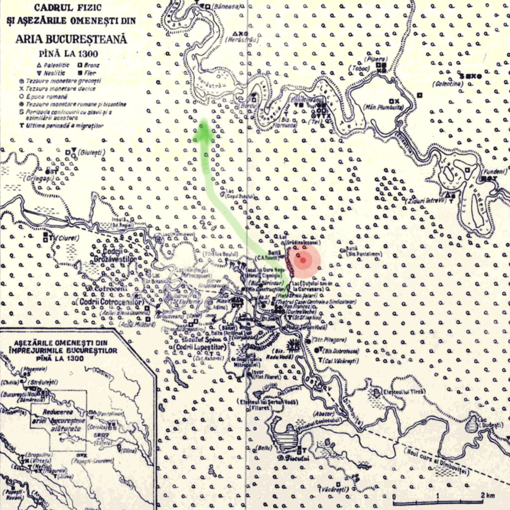
Istoricul Constantin Giurescu publică o schiţă cu locuirea acestei aşezări înainte ca ea să fie certificată de hrisovul celebru al lui Vlad Ţepeş care se constituie în act de naştere oficial al Bucureştilor. Locul pe care se ridică azi casa din Caragiale nr. 11 era cu mult în afara zonei de locuire, într-o parte ce a rămas multă vreme una mlăştinoasă.

Fireşte, n-avem planuri care să confirme această distribuţie a oraşului medieval pentru că primele hărţi le avem abia de la armatele ruse şi austriece care, la primele lor “vizite” de ocupaţie ale Bucureştilor în confruntările lor cu Imperiul Otoman, au avut nevoie să reprezinte grafic situaţia de pe teren. Se pare însă că, pe la finele secolului al XVII-lea, limita de nord a oraşului ar fi ajuns abia pe actualul traseu al străzilor C.A. Rosetti şi Maria Rosetti, astfel că zona noastră de interes se afla chiar în marginile locuite ale acestuia.

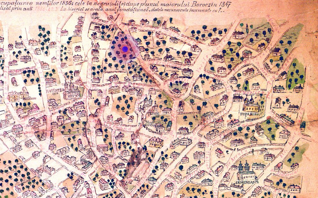
Primele reprezentări vizuale ale situaţiei reale din teren ne vin însă de prin ultimii ani ai secolului al XVIII-lea iar planul cel mai uşor de urmărit este planul din 1789 al lui Franz Baron Purcel. Pe acest plan putem să desluşim singurele repere pentru Bucureştii vremii, bisericile Batişte (identificată pe acest plan ca biserica Mănciulescu), Oţetari şi Icoanei (fostă Ceauş David), triunghi religios care determină aproximativ în centrul său de greutate locul care ne interesează azi, loc în care se află amplasată casa construită un secol mai târziu, în strada I.L. Caragiale nr. 11 de astăzi.

Acest loc este una dintre limitele fizice ale Bucureştilor care marchează trecerea sa din vremurile medievale în modernitatea anunţată de Brâncoveanu şi promovată încet prin domniile fanariote ce au urmat.


